
The aftermath of the Hunga Tonga-Hunga Ha’apai volcano and tsunami at Ha’atafu Beach Resort on the main island of Nukualofa - 40 miles straight south from the blast. Photo courtesy Steve Burling.
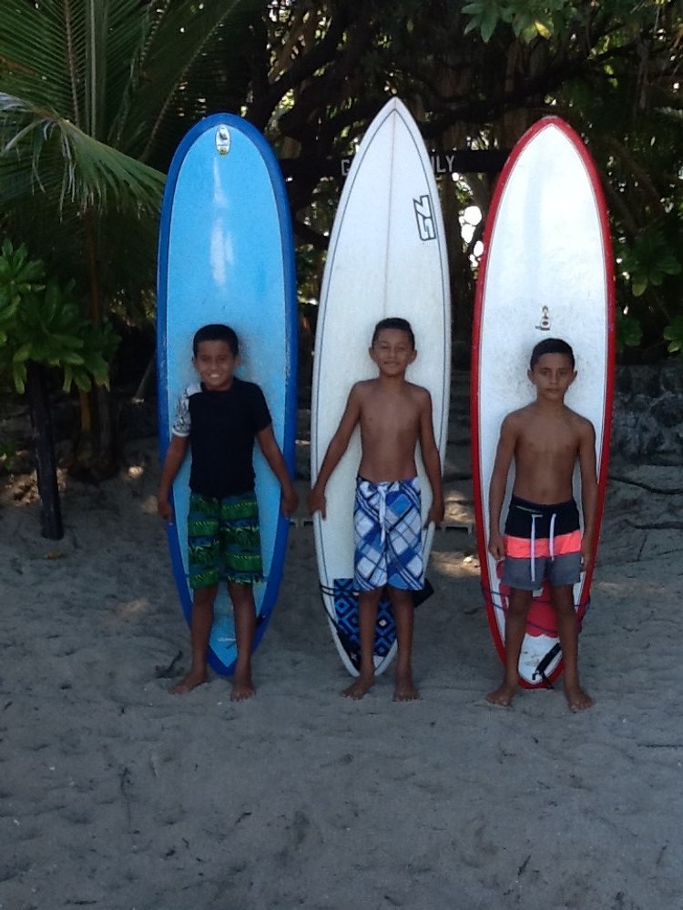
A long time ago, in a decade far far away, during a time called “The Nineties” SURFER Magazine did a boat trip to the Ha’apai Group of Tonga. The members of the trip were photographer Jeff Divine, videographers Sonny Miller and Todd Lynch, surfers Todd Miller, Kelly Slater, Jeff Booth and Tom Carroll and Your Humble Narrator.
From the main island of Nuku’alofa they took a boat ride with Kiwis Allan and Lynn Bowe, about 40 miles northeast of the main island, to an island in the Ha’apai Group that was called “Akesa Island” in the SURFER story but will be designated K_______ - although protecting the name of this joint could be silly as it might not be there any more. Or is covered in a six-foot layer of toxic ash.

K_____Island as seen from Google Maps. This photo was taken some time before the volcano exploded. It probably is not as pristine now.
Out on K_______ island, the boat anchored in a protective cove which was home to a particularly friendly and very large barracuda. The surf spot was a left reef of quality that broke in a pass, and it was good value to see those four guys take it apart.
At the time in the mid-nineties, Kelly Slater and Tom Carroll were two of the best surfers in the world - if not the two best surfers in the world. Incredibly, phenomenally Tiger Woods-skilled and athletic - those takeoffs were fast as lightning - and it was really something to see those two quick fellas toy and destroy a semi-serious wave over a coral reef out in the back of beyond in the South Pacific.
(If YHN could have anyone’s skill at any wave, it would be Tom Carroll in his prime at 10 foot Mundaka. Yeah baby. YEAH!
And yes, this wave is where YHN witnessed Kelly do his now-mythical duck dive takeoff, but enough about that because no one believes it)
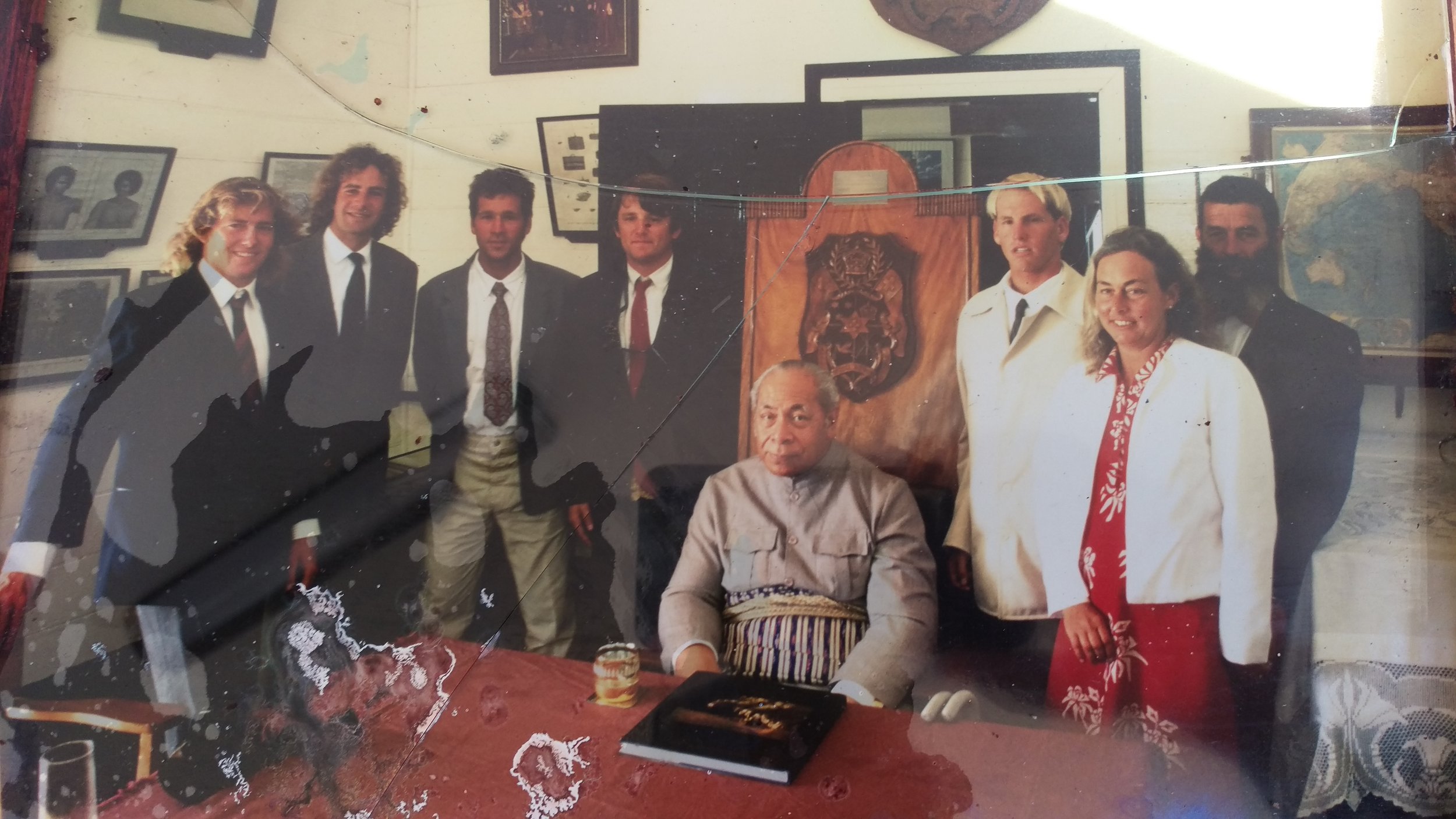
Hanging with His Majesty. From left: Sonny Miller (1960 - 2014), Todd Lynch, Jeff Booth, Your Humble Narrator, Tāufaʻāhau Tupou IV (1918 - 2006), Todd Miller, Lynn Bowe, Allan Bowe. Photo: Jeff Divine.
Back in Nuku'alofa, your Humble Narrator thought it might be clever to arrange an audience with Tāufaʻāhau Tupou IV the king of Tonga. Tonga is a constitutional monarchy and this was serious business and YHN was the protocol officer: Is it permitted to shake His Majesty’s hand? How do we address him? What do we wear?
The crew were asked to wear jackets and ties in the middle of the day in the middle of the Pacific in the middle of the earth, 21 degrees south of the equator. But all went well.
(Despite the Protocol Officer committing a serious gaffe, and drinking his mango juice before the King drank his. Doh!)
There weren’t a lot of Tongan surfers in the mid-90s, so it was funny that this present king had been featured surfing in the National Geographic for March 1968 (Vol. 133 No. 3).
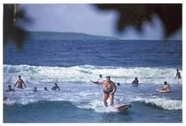
The King of Tonga, large and in charge on a big Hobie surfboard, as seen in National Geographic in 1968.
(As a sidebar, Dick Metz claims he sold the king that board. He was manager of the Hobie Shop in Hawaii in the mid-60s when the king came in with a Secret Service agent. He wanted a board and Dick screwed up the courage to ask the king how much he weighed. He was a big bugger was Tāufaʻāhau Tupou IV but Dick got an answer and did the math and they shipped the board all the way to Tonga and soon enough it was there in National Geographic.)
So his majesty dug surfing and enjoyed watching Sonny and Todd’s video of Kelly and TVC and Todd Miller and Jeff Booth taking apart a left reef way out in the middle of his Kingdom somewhere.
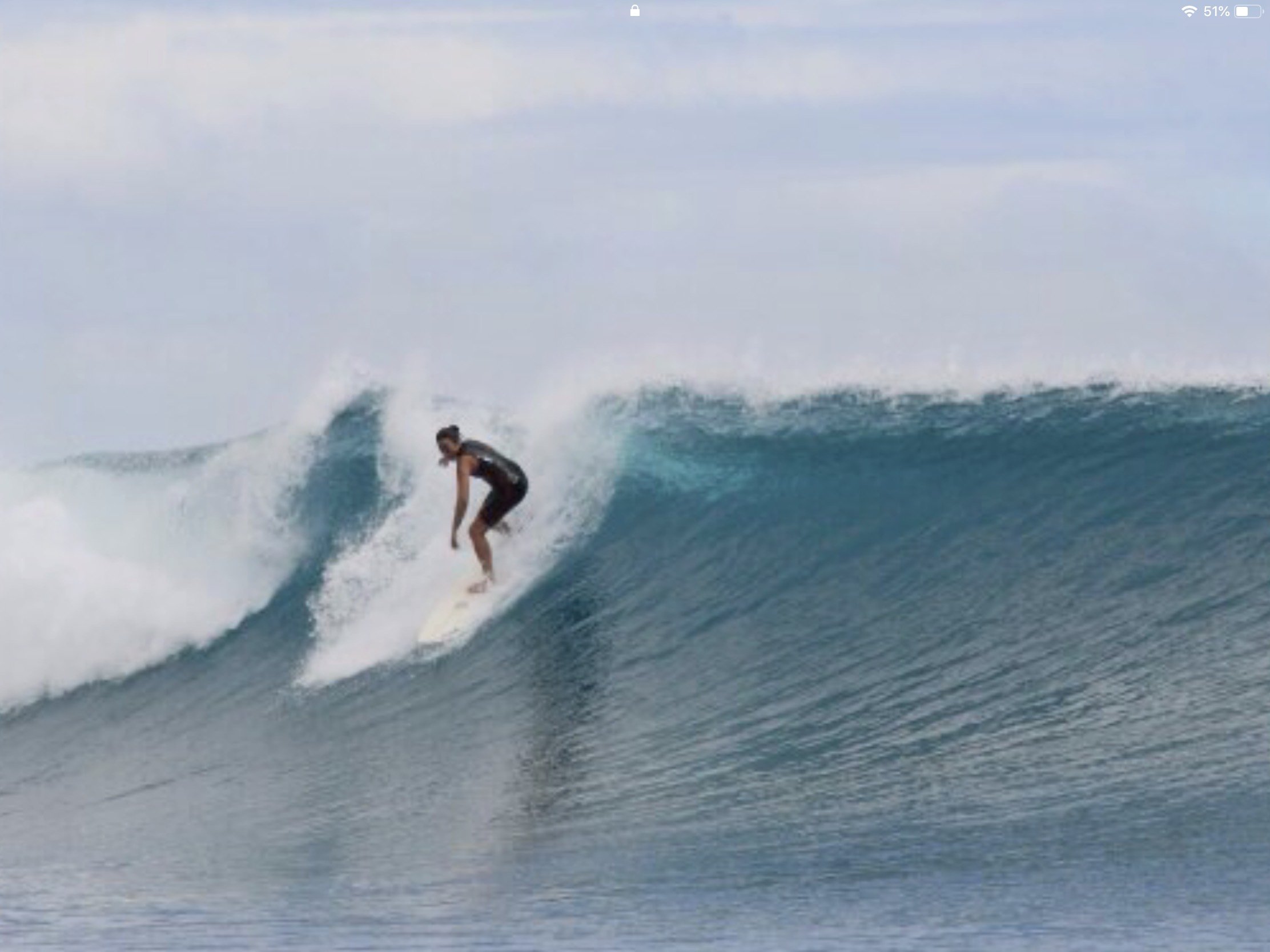
GALLERY OF THE EXTENDED BURLING OHANA & HA’ATAFU RESORT

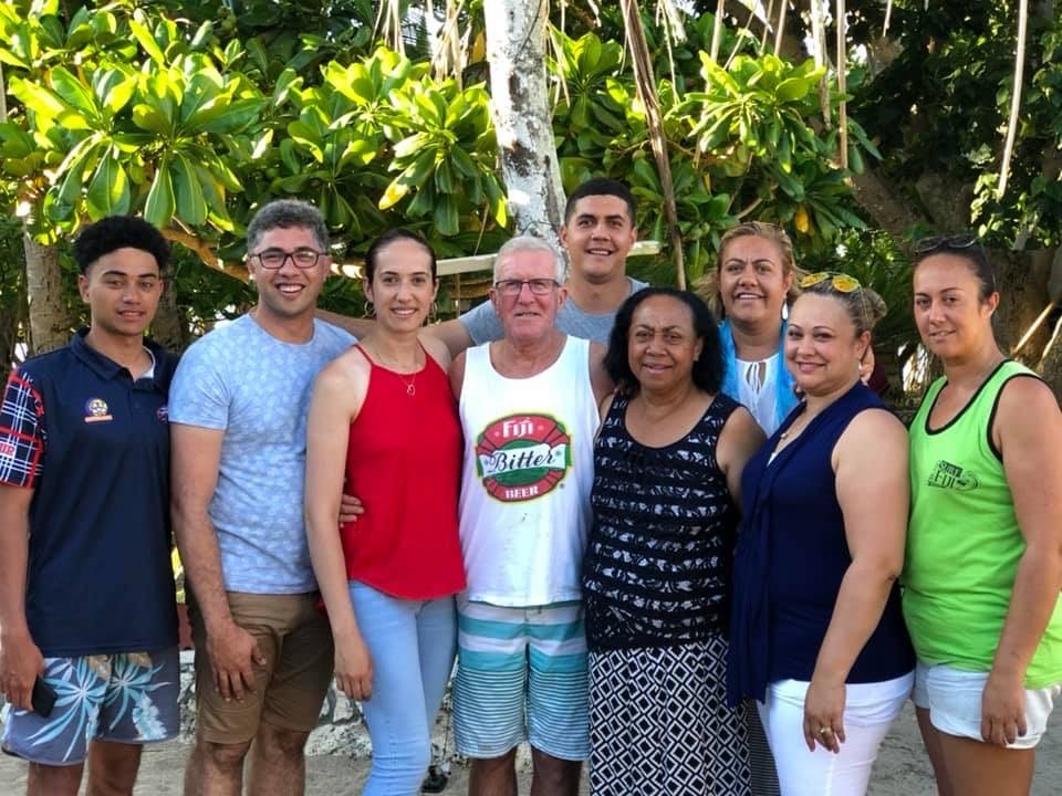

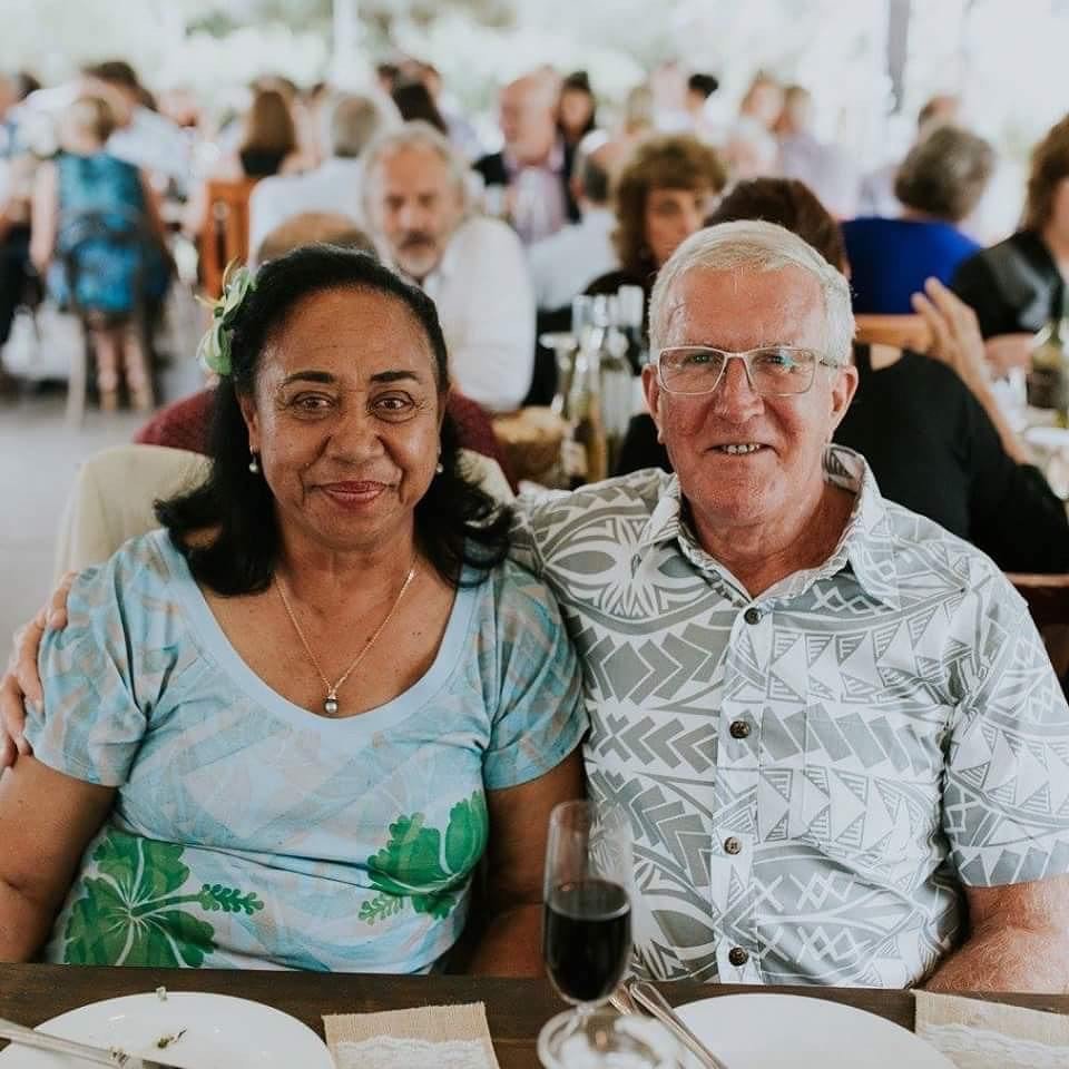


On Nuku'alofa the crew also enjoyed the hospitality of Australian Steve Burling and his family and if memory serves he had a Tongan wife and at least three tall, lean daughters who looked destined to grow up into super models.
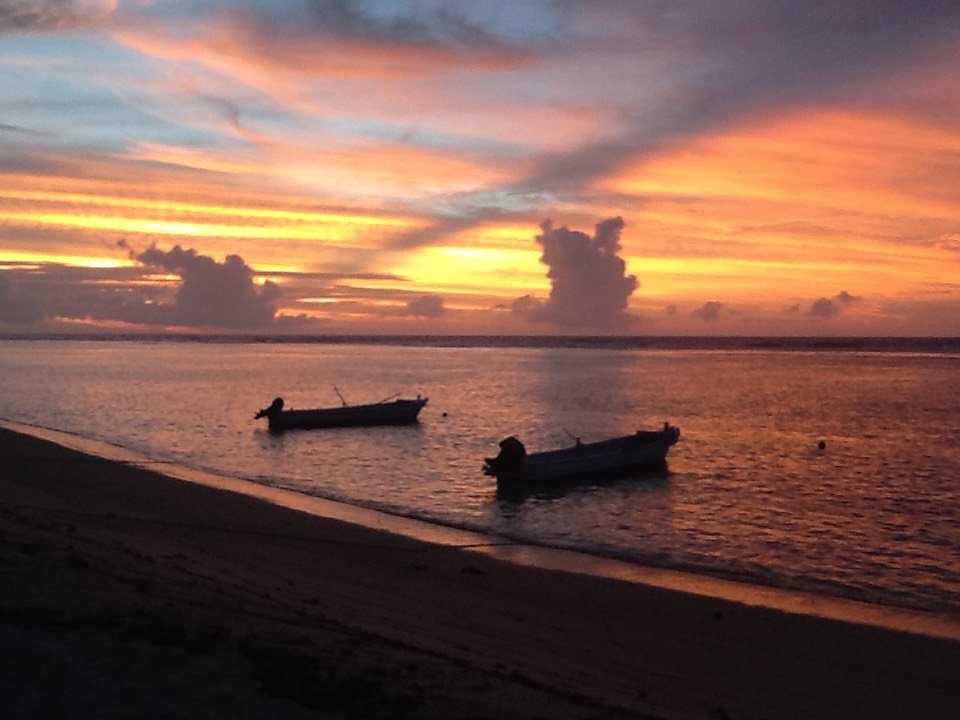
So what? So it was a little shocking when that volcano went off somewhere in the Tongan archipelago and it was identified as the Hunga Tonga-Hunga Ha'apai volcano.
The Ha’apai part caught the eye of YHN and sure enough, looking on Google Earth, that volcano went off about 40 miles southwest of where TVC and Kelly and Booth and Miller went off, way back in the 1990s.
A massive volcano. Visible from space. The air disruption was measured in Miami Fricking Florida: More than 7000 miles away.
When Krakatoa went off way back in 1883 it released an estimated 200 megatonnes of energy - that’s 2000 pounds x 1,000,000 x 200 = 400,000,000,000 pounds of TNT.
Was Hunga-Tonga even bigger than that?
No it wasn’t, according to CNN, but still an astonishing amount of energy:
The eruption this month of an underwater volcano near Tonga was hundreds of times more powerful than the Hiroshima atomic bomb, according to NASA.
Jim Garvin, chief scientist at NASA's Goddard Space Flight Center, said the eruption of the Hunga-Tonga-Hunga-Ha'apai volcano on January 15 released "hundreds of times the equivalent mechanical energy of the Hiroshima nuclear explosion," referring to one of two atomic bombs dropped by the United States on Japan during World War II.
"This is a preliminary estimate, but we think the amount of energy released by the eruption was equivalent to somewhere between 4 to 18 megatons of TNT," Garvin said on NASA's Earth Observatory website.
In comparison, scientists estimate the 1980 Mount St. Helens eruption released 24 megatons of energy, and Krakatoa -- one of the biggest volcanic events in history -- erupted in 1883 with 200 megatons, according to NASA.
The eruption near Tonga sent volcanic material surging as high as 40 kilometers (25 miles) into the atmosphere and generated tsunami waves up to 49 feet (15 meters) high that hit parts of the archipelago including the Pacific nation's main island.
When there are questions of geology and plate tectonics and tsunamis and that, the smart feller consults Judith Sheridan PhD - aka Geology Judith - a gal who is fond of bodysurfing big days at Ocean Beach - which some might say isn’t so smart - but who is sharp as a whip when it comes to earth sciences, plate tectonics, volcanoes and that.
YHN wondered if it was possible to estimate the energy release from the Tongan volcano, but got back much more than that. Her information came in wavey bursts - like a tsunami - but from a great deal of information, YHN got this from Geology Judith:
My expertise includes earthquakes, not volcanoes. But we are all familiar with problems comparing complex physical phenomena.
The size of anything depends on who is asking the question and what they are trying to describe. A single surfer will feel the energy differently riding waves in various six-foot, 17 second swells. Different surfers will still feel or describe the energy differently when riding in the same swell or even the same wave depending on surfboard, fins, stance, takeoff...
A single number is a clunky tool to characterize "size" of a complex physical process. Earthquake magnitudes and the volcanic explosive index (VEI) have the same drawbacks. While earthquake magnitudes are calculated using standardized measurements of ground accelerations (or ground displacements or velocities), the VEI attempts to take into account the magnitude or amount of material erupted and the intensity or speed of the erupted material which requires estimates, assumptions, and simplifications.
Volcanic eruptions move around rock, magma, ash, and gasses and amounts are difficult to measure or even observe. Not all of the material that is shifted ends up coming out of the vent. Submarine volcanoes do not have instruments on the flanks monitoring activity. Once the eruption starts even surface processes are out of view or instrumentation is destroyed. Gas compositions vary and volumes are difficult to estimate. Eruptions can trigger associated landslides, submarine slides, and tsunamis.
Based on standard measures available during the eruption this week, the surprising scale of the resulting tsunami and atmospheric waves is going to teach us a lot. We know that now, even before the first estimates of the magnitude and intensity of the erupted material are made.
The Hunga-Tonga Ha’apai volcano was possibly even bigger than Krakatoa. And it shook up the world.
A displaced Californian named Tony Stincelli who lives on Vanua Levu island in Fiji “on the south side 10 kilometers west of Savusavu town, which is in the bay,” heard the rumbling from 500 miles away. On Facebook, Stincelli said:
I'll tell you ..... we're 500 miles away and you wouldn't believe the hour long explosions and shaking from it here. It was roaring thunderous ground shaking explosions for over an hour .... lots of small tsunami waves breaking across the lagoon out in front.
Displaced California surfer/coastal engineering PhD Jose Borrero was in Gisborne with his family when he thought he heard a distant thunder:
I didn’t hear the booms, but people around here did. I am in Gisborne on the east coast at the moment.
When the booms were happening I was trying to get my kids to stop talking and eat their dinner. Also, we were in a beach front house at the time and there was a lot of wind and a pretty big swell running, so there was a lot of white noise around. The people I know that heard it were a few km inland in a quiet forest area and they heard it over top of polite dinner conversation. They thought it was fireworks from a nearby speedway that does them on Saturday nights, but it was still daylight, so it didn't make sense.
The next day we had a cyclone (Cody) spin by the coast about 200 km off shore and the swell got real big for a while (still too big now for the beaches out back). Maybe this afternoon or tomorrow morning the swell will clean up back to surfably fun levels.
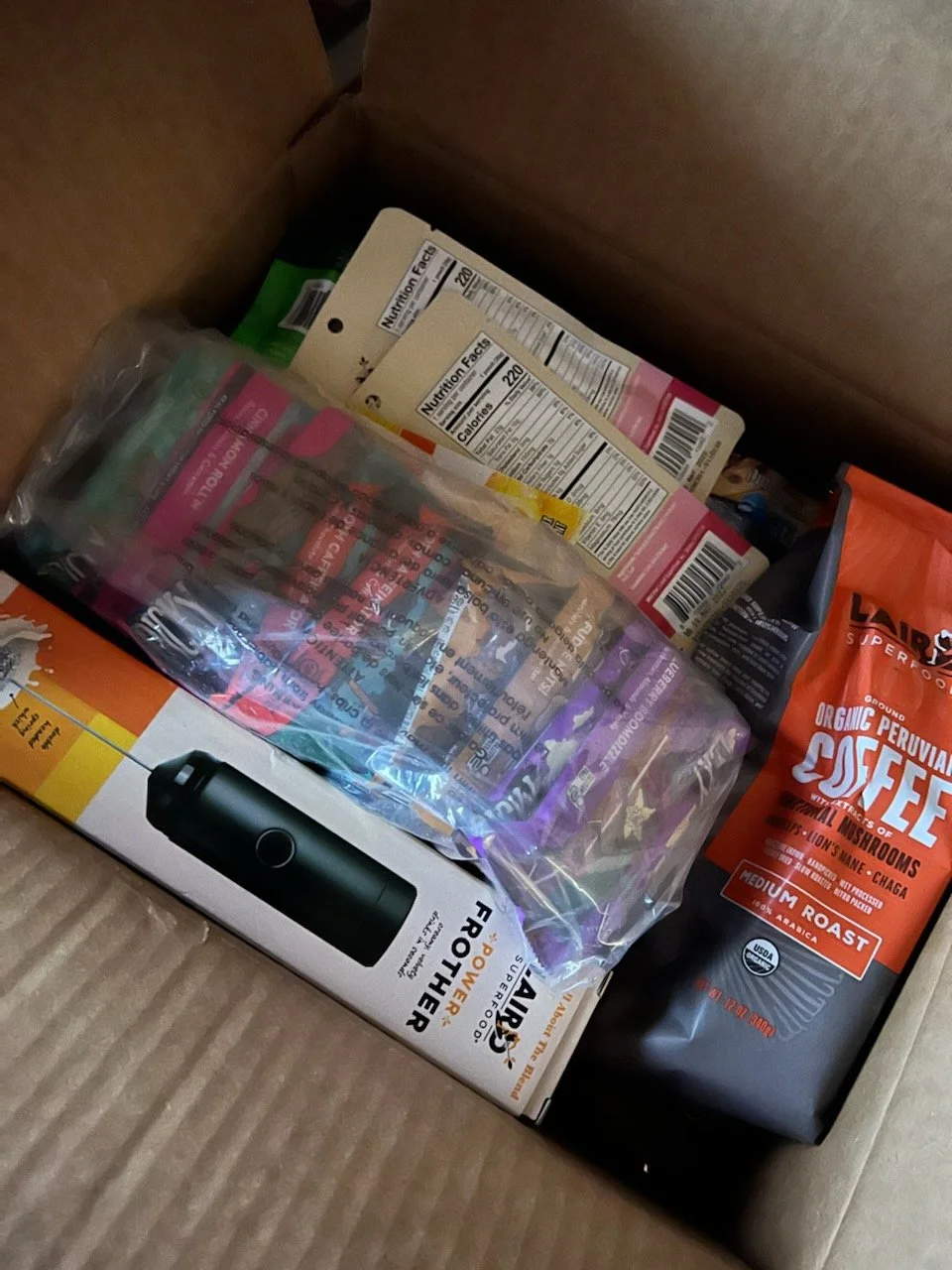
The CARE package of Laird SuperFoods. Thanks to GRH for this. Photo: Victoria Marie.
Back in California, around the same time, Laird and Gabby Reece-Hamilton were kind enough to send a CARE package of Laird Superfoods for YHN which was enjoyed by one and all.
In fact, a young surfer gal named Victoria Marie was pouring Laird SuperFood Creamer into her morning coffee on the morning of Saturday, January 15 when she decided to bail from her beachfront home on Malibu Road and head for the Valley, just in case that energy decided to show face in Malibu and take out some balconies.
There were reports of serious tsunami activity on the island of Kauai, where the Reece-Hamiltons hibernate for the winter.
In thanking the Misses for sending all that, YHN asked:
Sounds like Kauai got some tsunami action from the Tonga deal.
Did Laird try to tap into that?
I know how he thinks.
Imagine foil-tapping into that kind of energy.
But there was no response.
There were stories up and down the California coast of civilians heading for higher ground while surfers headed the other way, hoping to tap into some of that tsunami energy - which is not a very smart thing to do because you never know when or in what form that energy is going to show up.
Years ago, Borrero and YHN worked together on a story with a topic of “You Can’t Surf A Tsunami.” YHN reckoned surfing a tsunami could be done if a dude was in the wrong place at the right time with a PWC and a good driver and nerves of steel.
Borrero argued it wasn’t possible to surf a tsunami, perhaps out of concern that some knucklehead(s) would actually try to do it:
Would you guys please stop spreading this ‘surfed a tsunami’ BS?! It’s physically impossible. Period. No one has ever surfed a tsunami. They have surfed normal swell waves superimposed on a tsunami wave. Talking about people surfing tsunamis is false and irresponsible because it gives people the wrong idea about what they should do in the case they are in the water at the same time a tsunami is happening. You simply cannot surf a 12 minute period wave, OK? Get over it.
Borrero at one point described the Santa Cruz Harbor as a “tsunami magnet” which was certainly true after the Japan earthquake and tsunami: As that energy came 4800 miles across the Pacific at about Greg Noll/Oregon border latitudes, down the coast 10 degrees of latitude, turned up into the Monterey Bay and then proceeded up the Santa Cruz Harbor headed from whence it came and did $17 million in damage - almost wrecking the entire O’Neill fleet and a lot of other boats.
And that was true again for the energy that spread out through the Pacific and covered 6000 miles from Tonga to Santa Cruz and flooded the Harbor again.
No waves breaking up the Upper Harbor this time, just a radical rise in water level that did more damage than one might think.
The Santa Cruz Yacht Harbor was a tsunami magnet in March 2011.
The Santa Cruz Sentinel for 1/19/22 reported:
The harbor estimates damages from Saturday’s tidal event to be as much as $6.5 million, according to Mac Laurie. For comparison, 2011’s tsunami event, caused by an 8.9-magnitude earthquake off the coast of Japan, caused $20 million in damage to the harbor.
Damages from Saturday’s event include utility infrastructure, damaged pilings and facilities such as restrooms and showers.
Waves from the tsunami flooded the restrooms and showers in the harbor with more than 3 feet of water, according to Port Commission Chairman Reed Geisreiter. Additionally, the waves knocked out the power throughout the harbor docks, a place where many people live aboard their moored boats.
But in all of that, the few people who have actually been to Tonga or know Tonga were concerned about the effect a 200 megatonne explosion 40 miles from the main island would have on the life and ecosystems of that distant archipelago.
A few days after the explosion, photos and news leaked out, showing the main island of Nuku'alofa covered in smoke and ash, and reports that the main communications cable linking Tonga to Fiji had been damaged or severed.
Your Humble Narrator was under the impression that Steve Burling’s Ha’atafu Resort was on the back, southwest end of the main island and so protected from the tsunami that washed ashore after the explosion.
But a look at Google Maps showed that was tragically not true, and Ha’atafu is/was located on the northwest peninsula of the main island, absolutely exposed to anything and everything thrown up by air and sea from Hunga Tonga.
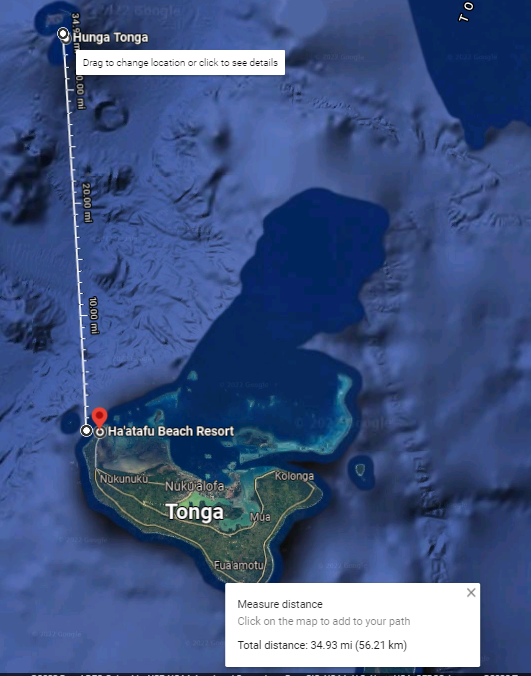
YHN sent emails out to Shane Peel and Martin Daly on Beran Island and Jon Roseman on Tavarua, asking about the status of their surf camps - as Tavarua is around 515 miles to the northwest as the frigate bird flies, and Beran Island is a further 2200 miles to the northwest in the Marshall Islands.
But again, you never know where that energy is going to show up. (Ask Hawaiian surfer Bobby Owens about Turtle Bay, way back when.)
Indies Trader CEO Shane Peel responded positively about Beran Island, but with bad news about Tonga.

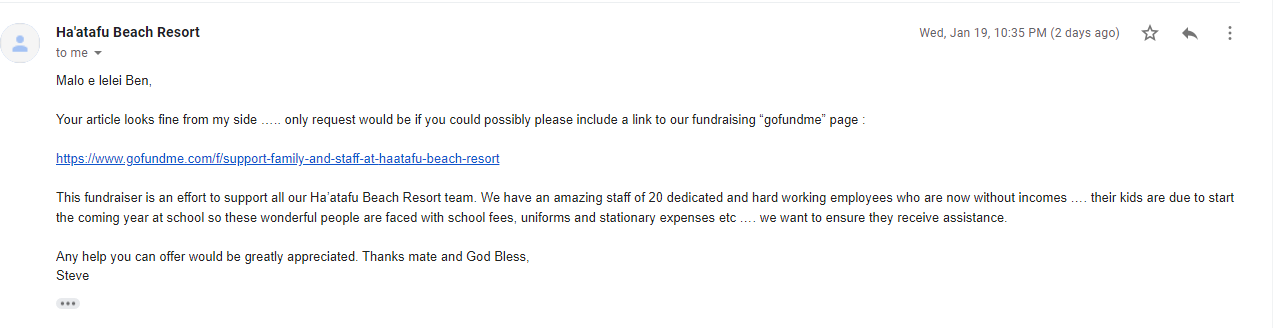
An email to the Burling camp went out soon after, not expecting an answer knowing about the wrecked communications cable. But on Tuesday, January 18, an email showed up late in the PM:

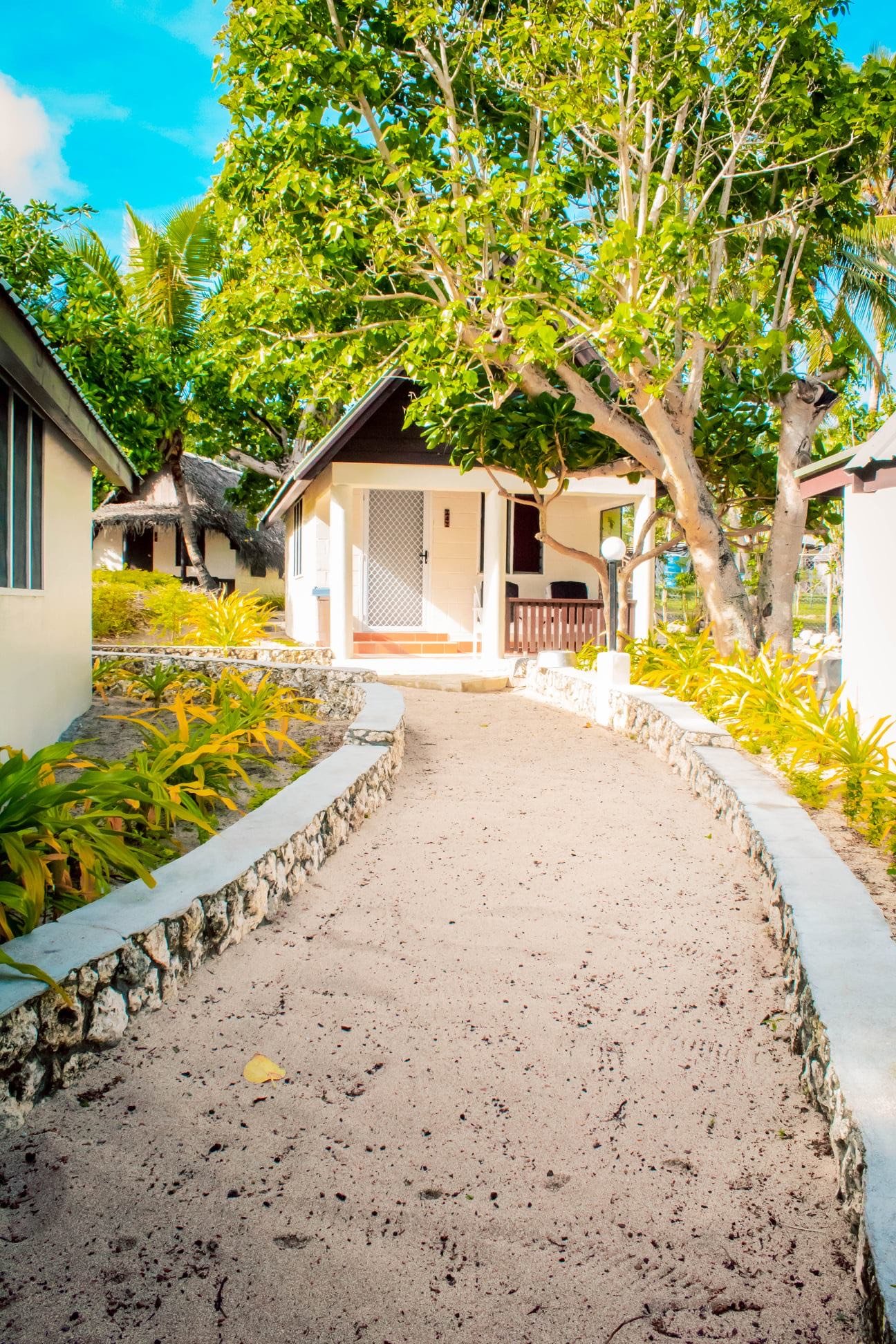
So another tragedy from the explosion. After many many years and a lot of hard work and sweat equity and memories and good times, the Ha'atafu Beach Resort is no more.
All reduced to smoke and ash.
Steve Burling described the evolution, tribulations and slings and arrows of Ha’atafu in an email:


No trees, no life, no mas. The aftermath of the volcano and tsunami on the Ha’atafu Beach Resoirt. Photo courtesy Steve Burling.
Burling also sent two photos and a video of what was left of the Ha’atafu Resort. And what else to say except: “That’s just God being mean, is all that is.”
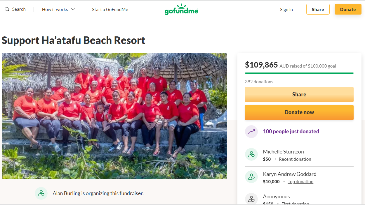
When Geology Judith read that email and saw the photos and video of the total destruction of a once-beautiful tropical surf resort, she said:

Decades of hard work and sweat equity and good times and memories: Gone in 60 minutes. Mother Nature can’t be sued for damages. My immediate reaction was to start a GoFundMe to help the family and staff, but that was already in motion and is still in motion.
Steve Burling approved of this message, but added a coda and caveat:
Here is a clickable link for the GoFundMe to help the staff of Ha’atafu Beach Resort
https://www.gofundme.com/f/support-family-and-staff-at-haatafu-beach-resort
As of Friday January 21 there seemed to be a whole lotta aloha floating around out there for Ha’tafu Beach Resort and the Burling Ohana.
But the future for Tonga is covered in smoke and ash. Recovery efforts are underway, but in the words of George Harrison:
But it's gonna take money
A whole lotta spending money
It's gonne take plenty of money
To do it right, child
It's gonna take time
A whole lot of precious time
It's gonna take patience and time, mmm
To do it, to do it, to do it, to do it, to do it
To do it right, child
P.S. On Friday, January 21, almost one week after the eruption and tsunami, Steve Burling sent this email:
Fri, Jan 21, 9:50 PM (4 days ago)
An update from Tonga… Moana called again late last night and had time to give us further details of their tsunami ordeal. Contrary to earlier secondhand reports we received, Moana said that the first tsunami waves stated hitting the Ha’atafu coast 20 minutes before the first major explosion (apparently there were multiple massive explosions). This would suggest that there had been some undersea collapse of the volcano’s crater … which may have been the prelude to the caldera becoming exposed to the seawater and creating the deafening “nuclear bomb” type explosions …. and the huge tsunami waves that struck the Ha’atafu coast.
There is video footage circulating (it has appeared on most global news reports) of cars fleeing with the approaching tsunami wave flattening a fence as it sweeps ashore and up the road towards the vehicles. That is the road leading to the beach at Ha’atafu and those vehicles are coming out of our resort driveway. Moana said that those were the first waves hitting the resort. She said that by the time they had ushered all their guests out, the waves were washing right up and over the resort driveway and that they were unable to even drive any resort vehicles out. They had to escape on foot through the bush at the rear of the resort and across the peninsula where they were fortunate to be picked up by a passing car. This was before the first major explosion and the resulting massive tsunami waves that washed right over the peninsula ….. taking out houses on the eastern side (Kanokupulu village). I reckon that seismologists estimates of 15 metre tsunami waves weren’t an exaggeration.
And then on January 23:
We’ve managed to get our first crate of relief supplies on the ship to Tonga. We still have the garage of our Auckland house bulging with food, clothes and bottled water that relatives, friends and previous regular resort guests have dropped off to send to Tonga.
Our daughter Moana and her husband Hola are convening a meeting of all the resort staff at the resort site today (Mon 24 Jan) to discuss future plans. After a lengthy conversation with Moana yesterday it appears that she and Hola are planning on putting the staff to work at the resort site to do a general clean-up and get the property boundaries re-fenced. As mentioned in my previous emails, we face many hurdles in rebuilding our business but having endured so many setbacks in the past, we feel confident in embracing the coming challenge.
Will keep you posted as this all pans-out.